
UAV tilt photogrammetry
UAV tilt photogrammetry
- Categories:解决方案
- Time of issue:2019-08-12 00:00:00
- Views:0
Program overview
In order to realize the efficient production of tilted 3D scenes and further expand its application range, Visiontek has launched a set of service solutions for drone tilt photogrammetry from hardware to software based on its profound R&D advantages, including drone flight platforms, ultra Lightweight multi-lens tilt camera, automatic 3D modeling software, tilt photography post-processing system, data release and application system, etc., which basically cover tilt image acquisition, modeling, model fine editing, model-based 4D product production, results release and application The entire process.
Program composition
Oblique image acquisition: UAV flying platform
The multi-rotor drone is equipped with a five-lens stabilization tilt camera to obtain ground tilt images.

Tilt image processing and 3D model construction: Virtuoso3D automatic tilt photogrammetry 3D modeling cluster system
The Virtuoso3D automatic tilt photogrammetry 3D modeling cluster system has the city-level tilt image data processing capability, and can smoothly complete the high-precision three-dimensional processing and fine 3D model construction of more than 100,000 tilt images in a single time, and cooperate with intelligent task division With the support of high-performance cluster hardware, it can effectively realize the efficient production of large-scale real 3D models, and the accuracy of the obtained models can fully meet the 1:500 cadastral map surveying and mapping requirements.

Model fine editing: MapMatrix3D map array three-dimensional intelligent mapping system
The MapMatrix3D map array three-dimensional intelligent mapping system has a series of model editing functions such as model flattening, flipping, mirroring, splicing, loophole repair, range cutting, hanging object cutting, absolute orientation, etc., which can comprehensively analyze the results of the constructed 3D model Fine editing makes the model have good application characteristics and give full play to its practical value.

Model range cutting Model water cavity repair
Model-based 4D product production: MapMatrix3D map array three-dimensional intelligent mapping system
The MapMatrix3D map array three-dimensional intelligent mapping system supports rapid and direct output of TDOM and DSM results with custom resolutions based on the three-dimensional model, without the need for image editing, and provides diversified feature collection modes and intelligent feature collection operations in a three-dimensional environment , Intelligently and efficiently complete the 1:500 large-scale tilt 3D mapping operation, and output the DLG results that meet the requirements.

Direct output of TDOM and DSM results based on the model DLGThree-dimensional mapping to generate DLG
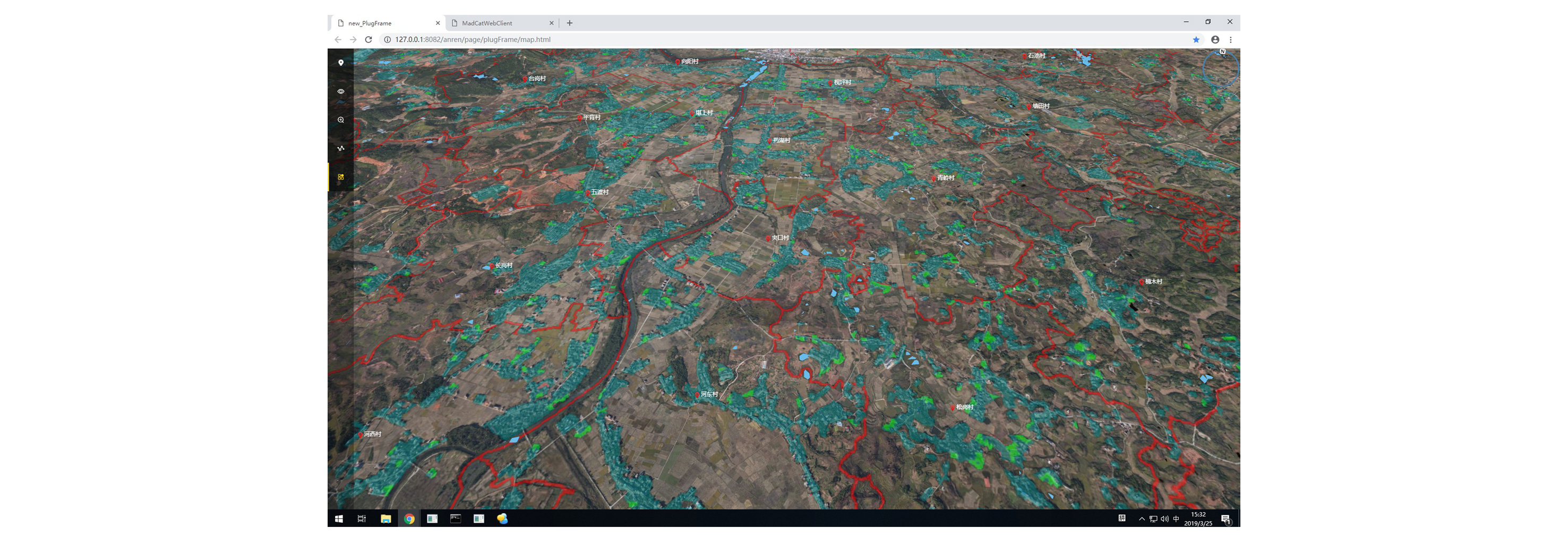
Large-scale oblique 3D scene publishing and application: 3DMatrixLite 3D real scene geographic information publishing system
After the acquisition of geographic information results such as the three-dimensional model in the early stage is completed, 3DMatrixLite can carry out the network release display and application of the project results.
3DMatrixLite 3D real-world geographic information publishing system is a pure Web-based, plug-in-free 3D spatial geographic information publishing application software based on mobile internet. It can publish massive amounts of tilted scene data on web pages and supports cross-platform operation on desktop and mobile terminals. The browser can be accessed, and it also has extremely convenient secondary development capabilities and rich model measurement, analysis, single management and other functions, and the application range is extremely wide.
Solution application case show
Smart city construction

Smart security for event venues

Land reserve resource survey
Comprehensive Land Remediation

Scan the QR code to read on your phone


Copyright © 2021 visiontek.com.cn All Rights Reserve 鄂ICP备05028744号-1 Powered by 300.cn
